
The Drone Factor Startup Story
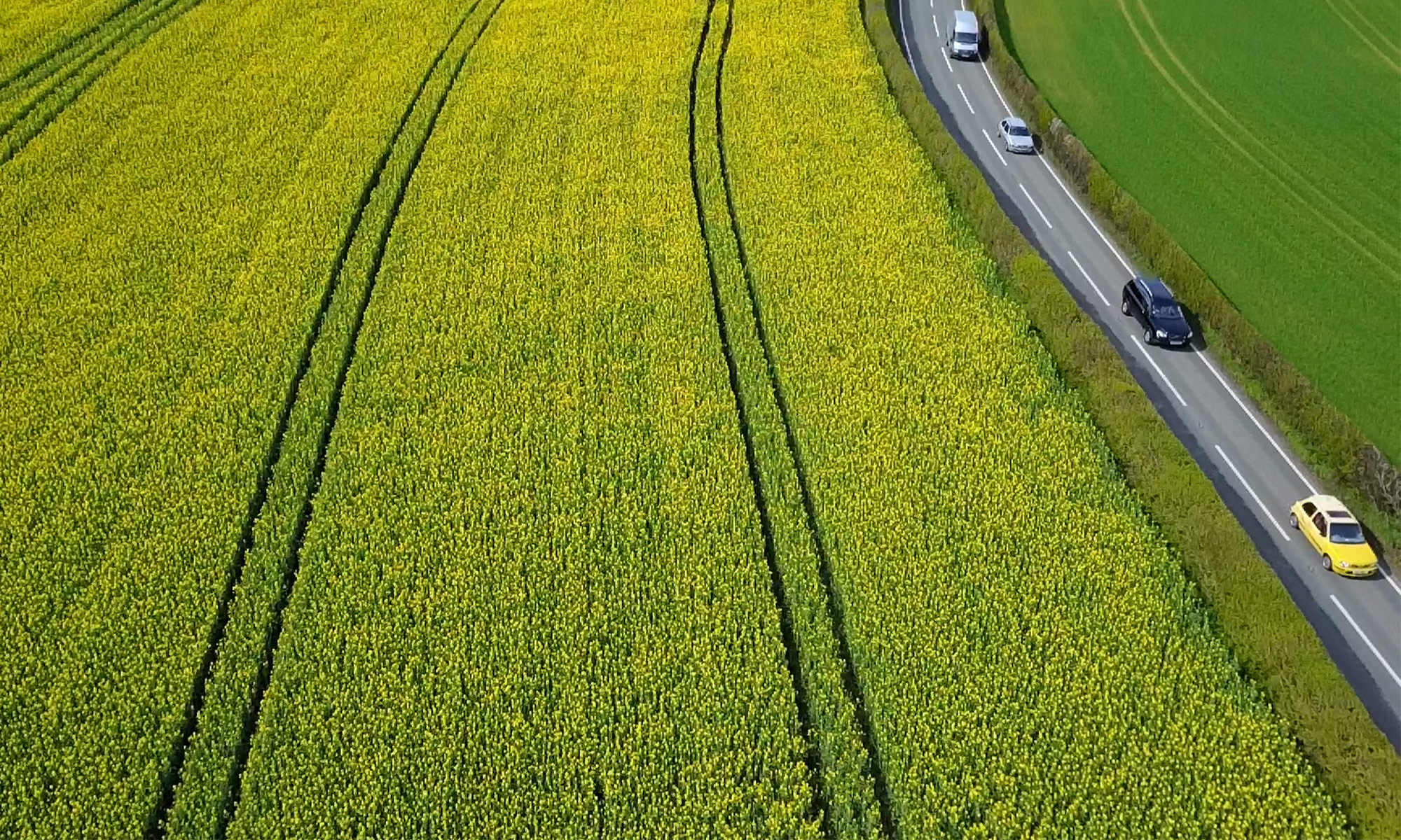
Drone Factor performs aerial surveys for corporate and domestic clients. We are also available to shoot cinematic film and photography for promotional use. We have 3D mapping services on offer that create accurate surveying and development models, along with image stitching methods that can create amazing maps of your sites.
“We spend time researching our industry and the future of it, so we all benefit from the freshest knowledge out there”
We started officially in April 2017, with 12 months experience flying drones behind us at the time. Our objective for the first year was to become a firmly rooted, knowledgeable and likeable business with lots to offer. We took off with the help of Wirral Chamber of Commerce’s Startup Team, the Enterprise Hub, based at the time at Pacific Road (eternal thanks to Lorraine, Alex and Jen!). At one point our business plan was 120 pages, with more than enough reading needing doing to understand the legalities and legislation that come with the territory. We reduced the size of the business plan.
We draw on years of experience in the creative, customer service and education sectors. We have solid, proven skills creating and teaching graphic and motion design, combined with technical photography know how and tech-savvy staff who push the limits of the systems to obtain the best results. Previous work in video production and sound recording studios across the northern hemisphere sets us in good stead for producing the high standard of work of which clients rightfully expect – our work in locations such as Whistler, Vancouver, Toronto, America, Tenerife, Liverpool and London backs up our claims.
Our in-depth knowledge of web design and mobile technology reinforces our knowledge when consulting, helping us to find the optimal solution for our client’s applications.
One (and a bit) years into our business, we no longer ‘feel like a startup’. We have solid links established with great clients, have been featured a number of times in local publications, we write for the Drone Safe Register (a national body of professional drone pilots in the UK and USA), and we are running workshops in the summertime for the Royal Photographic Society.
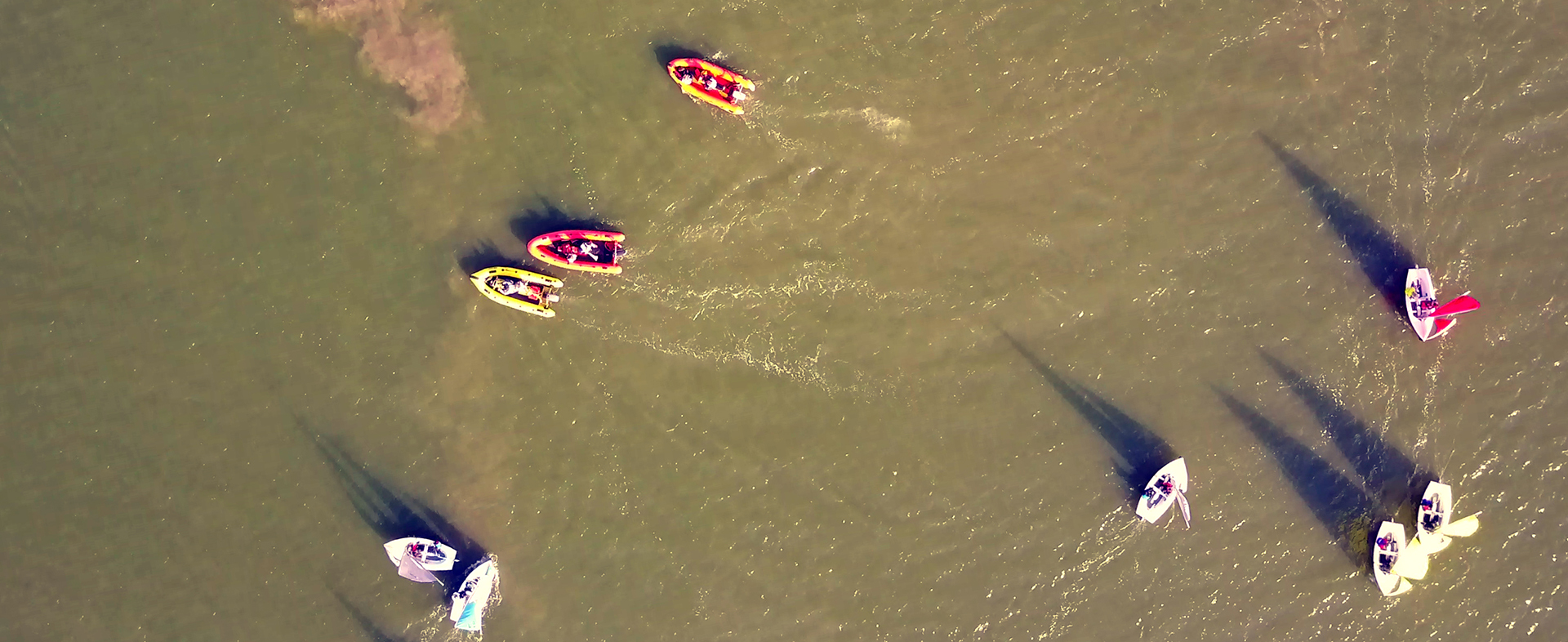
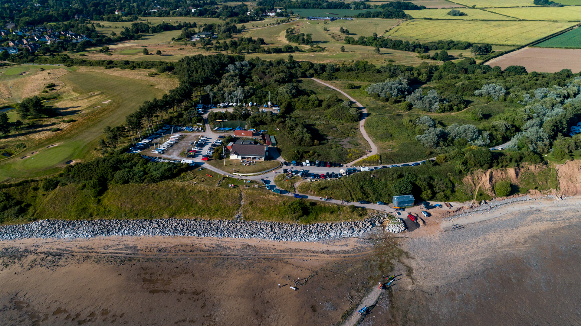
We supported the Wirral Kayak Challenge, creating stunning footage for use promoting the event next year and beyond, and have more to offer charities in the remainder of 2018 by way of unique content for promotion. We are speaking at colleges and conferences, highlighting drone technology in education and helping teachers integrate it in the curriculum. We are making waves, as we like to say.
We spend time researching our industry, and the future of it. We help out clients understand the technology we use, we don’t just show up, fly and leave. This helps everyone see the upcoming technology and what it’s capable of, and know it’s current limits. We enjoy the learning process and everyone we work with enjoys the benefit.
The three ingredients in our business recipe:
A combination of passion, confidence and knowledge.
We go into schools and update teaching staff on the content they can be creating that will prepare their learners for a drone – friendly future. There’s a lot to be said for letting kids know what options there are available to them in years to come; jobs that even we at Drone Factor are not even doing yet! We aim to drive the industry forward, creating the jobs for our future generations, securing their livelihoods and putting food on tables of people we may never know.
More recently we have started to explore how our work can have a postive effect with conservation efforts. We are piloting various schemes in the Northwest, and will be publishing our findings in due course. Our objective is to be zero carbon by Q4 2019, and we are already a long way toward that goal.
We look forward to continuing to work with our amazing clients, carrying out the most interesting and fulfilling tasks we have seen in our careers. If you want to work with us, in research or in business, send us and email to start the conversation.
Top image: Wilson Trophy Team Racing at West Kirby Marine Lake, 2017
(See how we make our aerial photography into artwork here)
Wirral Kayak Challenge 2018 Reel
This year the inspired Wirral Kayak Challenge saw perfect weather, calm waters and brilliant sunshine around the stunning Wirral Peninsula.
10 hours, 15 miles, 86 kayakers. See more stats from the day.
Drone Factor pilot Sam took to the waves aboard National Marine Safety boats to film the event from the air, capturing incredible footage of the participants in their boats as they broke a considerable sweat in the salty air.
Wirral Kayak Challenge 2018 Highlight Reel
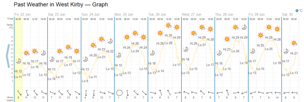
Top achievement by fab, selfless individuals raising money for all sorts of charities, an obviously huge congratulations to everyone for completing such a challenging event in such hot conditions! 23 Degrees Celsius apparently as a peak, but when you’re miles from shelter, with water doubling the suns rays, it’s definitely a lot more.
(screen grab from timeanddate.com)
Many thanks to National Marine for making this event safe and ultimately ticking the health and safety box – without their safety boats this would not have been viable.
A massive thank you to Mike, Gill and the Wirral Kayak Challenge Organising Team for putting so much time into the event to make sure everyone had a safe and successful day on the water.
A thank you also in order to Dee Sailing Club for receiving the weary travelers at the end of their challenge!
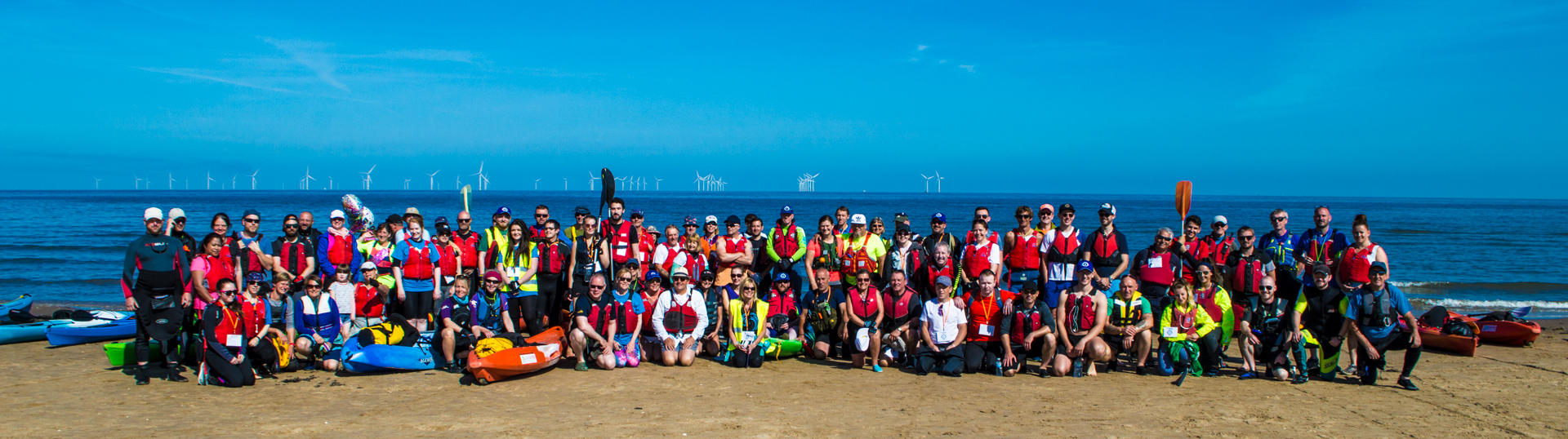
Zoomable version of the group photo!
(tap or hover your mouse over to zoom in)
WKC Finish Line Stats
Above image title “Dee Finish Line”; another image from the Wirral Kayak Challenge series. A shameless pun, most definitely intended. 😛
The BBQ put on by the wonderful Wirral Holistic Care Services team was something to behold: well done to all, you really held it together with the heat and the hunger generated by a total of 1320 cumulative miles paddled by the swarm of Kayakers!
Check these stats out:
The average calorific burn for a kayaker is 340 cal/hour. Let’s up that to 400 because of the heat, and add another 20 for the salty air, and bolt on an additional 20 for the added weight of lunch/kit people were carrying aboard.
Call it 440cal/hr. Sounds about right. Jogging is 238, according to the internet.
The challenge set off at about 09.30 and the average end was 18.30. That’s a total of 9 hours, minus (let’s say) 2.5 for the break on the sandbank beyond Hilbre Island. We’re balancing the calorie burn whilst in the heat there too.
That works out at 7.5 times 440, which is a total of 3,300 calories burned, per person and that’s only from the paddling activity! A total of 290 000 calories.
Crikey.
No wonder there was a queue for the Wirral Holistic Care Services barbecue! What an achievement!
Some other comparative statistics:
79 200 feet – the distance paddled by each kayaker
Total distance paddled: 15 miles from the start point at Wallasey Golf Club, across to West Hoyle Bank (beyond Hilbre Island by about 1.5km) and then to Dee Sailing Club, near Thurstaston Country Park/Caldy Golf Club.
10 000 – the average paddle number of strokes per participant
That’s 880 000 paddle strokes between the entire cohort! These are some big numbers! We’re not sure about paddleboarders, perhaps you guys would like to make a guess!
29 029 feet – Height of Mt. Everest
According to an article in the Independent, a climber burns 10 000 calories a day, which WKC participants were one third of the way towards by the end of the day!
Those who were sponsored for the event are urged to send in their stats – how much did you make for your charities?
We’d love to gather a grand total! All charities will be mentioned in a mega-post at some point too!
If you have any other fun statistics, like how many sandwiches you had for lunch, how many litres of water you drank, how many hours training you put in… let us know!
Post your stats over on our Facebook, and we’ll update this page and incorporate it into the mega post when we post it!
Luckiest Location Location Location
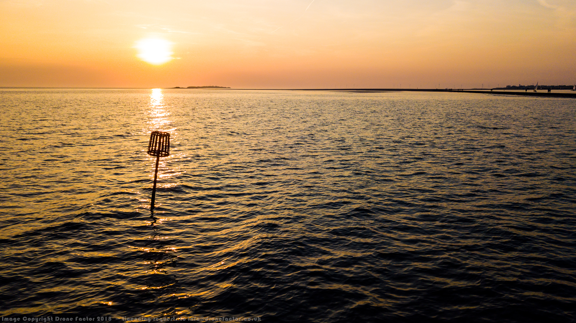
It’s safe to say that today was a hot one, and this sunset photograph is a nicely suitable way to remember it. The image above was captured this evening, as high tide and sunset coincided. A rare day where the golden sun over the Irish Sea showers over the evening strollers around the Marine Lake on the tip of the Wirral.
The funny shaped lollipop poking out of the water is a radar reflector,designed to be visible in all weathers to ships coming into the Port of Mostyn
Docks over the water on the North Wales coast, and the fishing vessels that come by from Heswall and Parkgate.
Flight Controllers – An Overview
Do you know your FCs from your ESCs? This introductory guide will help explain the RTH from the RTB, the Rx from the Tx, the CCW from the CW and the Aero from the Eebee.
Check out this ever expanding glossary!
Disclaimer: this is an overview! This is a semi-generic guide that is aimed at enlightening those who would like to know more about how drones work. This guide is not a Masters in Drone tech in a few pages, but you will learn a lot!
How to begin explaining something so complex?
Well, it’s actually relatively straightforward to construct a drone from component parts: drone racers and hobbyists have been doing this for a long time. The majority of the technology – motors, servos and the ways in which they are controlled are all taken more or less directly from the remote controlled model world.
The Flight Controller
The RC world did not use flight controllers as we know them today… the flight controller is the central hub of the system, processing the balance, the motion, motor speeds, aircraft movement (Inertia Measurement Units), GPS/GLONASS positions, altitude, attitude (angle relative to the earth) and any waypoint data. All in all, it’s quite a busy little box, and that’s just the start!
Many flight controllers have multiple IMUs, interia measurement units. The IMU is essentially a sensor that detects movement, or changes in movement, so the drone can calculate it’s inclination (angle relative to the ground/earth) and it’s azimuth (bearing, relative to the compass or magnetic north). These two pieces of information are critical to the steady and ‘flat’ flight we are used to. If anything is out of kilter, or if these sensors are calibrated incorrectly or not calibrated to their environment) the drone will do odd things, and quite likely crash. The addition of a GPS unit and compass (commonly incorporated into the same device) adds an additional layer of protection, but another layer of information to deal with.
If you haven’t heard of the research group ETH Zurich, spend a moment looking up their creations. This team created a code, or protocol, called MavLink. This powerful coding system for flight controllers is what powers a lot of our drone systems, and looks to be the benchmark and the go-to for building custom systems.
Next episode: The Sensors