NB: This business is currently only available for bespoke flight missions.

THIS WEBSITE IS BEING KEPT LIVE FOR REFERENCE PURPOSES.

Drone Factor is currently on a sabbatical

Drone Factor is Making Aerial Affordable

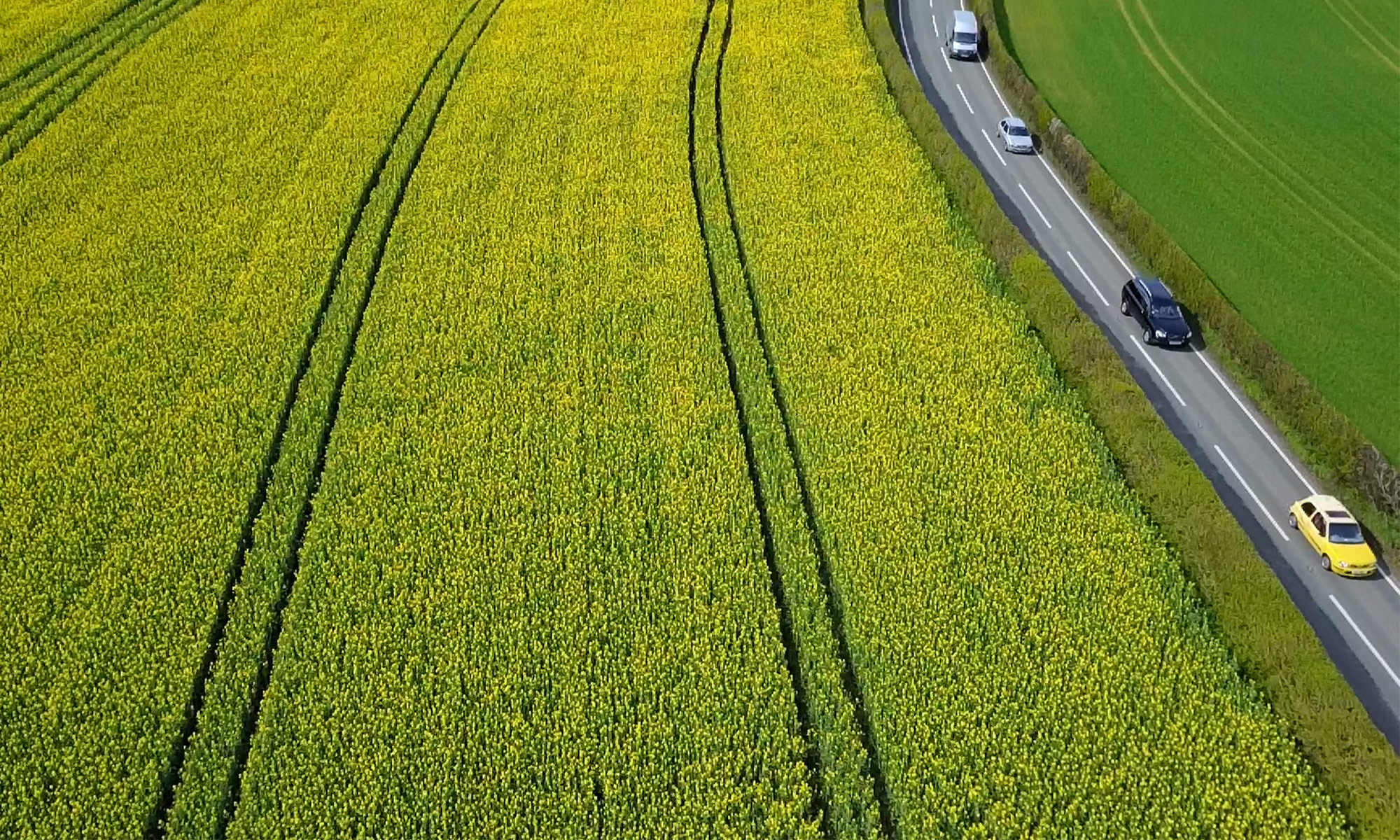
Everyone knows that Drones are becoming a must-have asset for projects – our systems and methods can rapidly capture critical data for projects such as demolition, inspection, conservation and surveys, along with cinematics.

We blend of skilled and licensed professionals with over 10 years in the TV and design and production industries, along with a core team with mapping and survey experts. This allows us to provide site surveys, inspections and forensic evidence services along with complete motion graphics combined with aerial cinematics.

We fly un-intrusive UAVs, investing in efficient and versatile systems for projects throughout 2019 and 2020. This means we’re able to do multiple flight missions with specific tasking to enhance data capture.

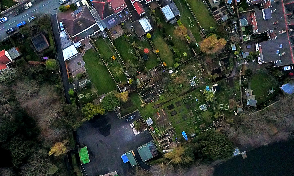
Back at base we have a dedicated office packed with software and the processing punch needed to crunch the numbers to generate 3D maps, and informative photogrammetry and to produce beautiful cinematic products for your to record events or promote your business with. We use Pix4D, Drone Deploy and a range of GIS software such as qGIS and ArcGIS.

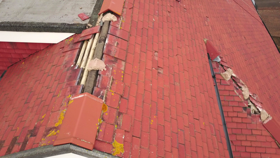
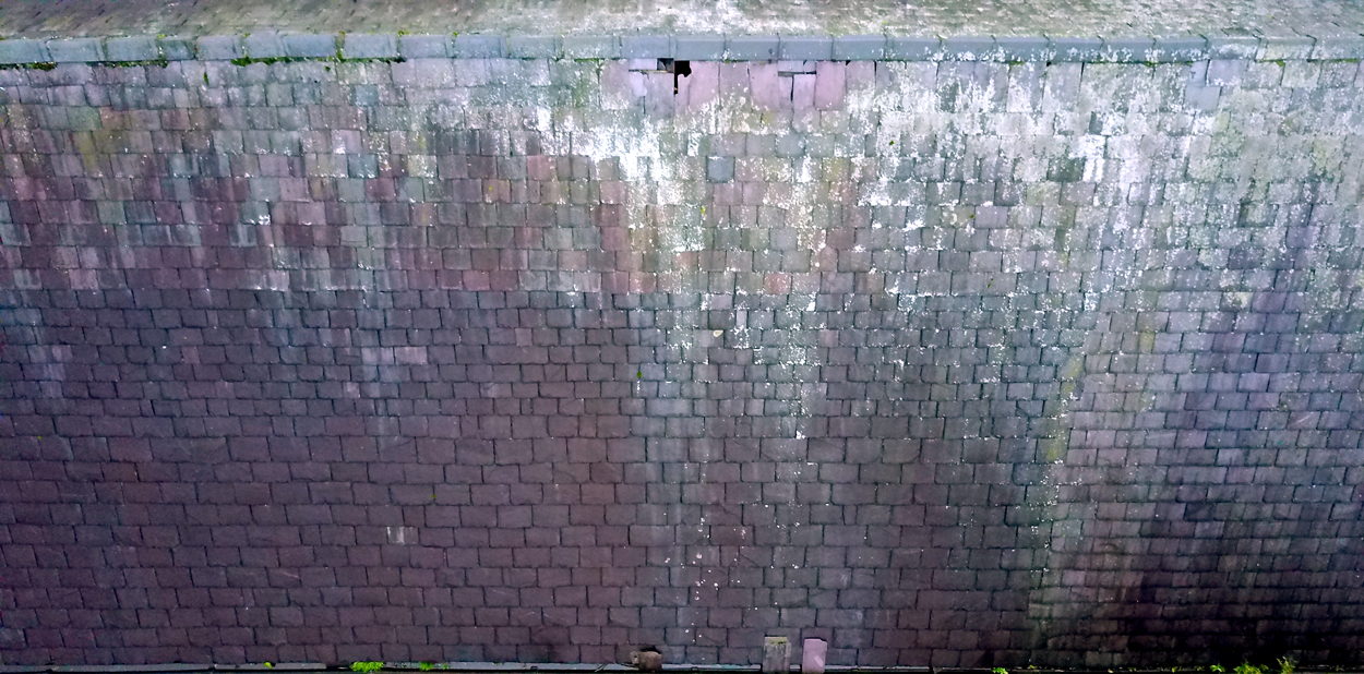
Drone uses and efficiency are unsurpassed – for example, whilst assisting with Merseyside Search and Rescue, we were able to cover 40 acres in just 8 minutes, allowing the team on the ground to save time, resources and potentially find their missing person more swiftly.

Aerial Inspections

Why use a drone?

Drones provide a rapid, accurate and most importantly safe inspection services for roofers, insurance companies, claimants and construction companies.

What do you do with it?

We send our drone to places that would otherwise be dangerous, tricky or costly to reach. Usually scaffold, cherry pickers, ladders and a lot hours are needed to gain the insights we get in under an hour.

We will provide you with close up, high resolution images of the areas you are most concerned about, along with a set of photographs for each part of the roof – North, South, East, West, plus a few from directly overhead to help plan repairs.

An example of what you can look at in the warm, with a cuppa:

This is the type of damage you can’t see from street level. This beats standing outside and guesstimating what’s needed. This also qualifies as evidence for claims, if need be. Overall, it’ll help get the job done faster and get your house nice and dry again.


Semi Detached Residential Property: Storm Damage
(Image Copyright Drone Factor Ltd 2017)

Five Storey Industrial Unit (Manchester)
(Image Copyright Drone Factor Ltd 2017)

Legal


We do all the flight planning, and we contact all of the relevant authorities and organisations to ensure the flight is 100% safe and legal. We’ll contact your neighbors too, informing them that the drone will be inspecting the roof and the roof alone. Flight plans are available to landowners prior to flights taking place, as are our credentials regarding insurance and pilot licencing.

More detail on our legal status.

Corporate Contracts

Drone Factor can accommodate a range of businesses. We provide regular surveys of large and small building projects. This enables you to track progress and identify potential issues using leading edge technologies. You could preemptively identify drainage issues, map precise land boundaries and check alignment from a visual perspective.

please note that images on the website are *not full resolution*

We assess costing on a per-customer basis dependent on your needs.
We  create a service contract will save you money and provide the services appropriate for your task. Large and small scale. Small or large areas. If there isn’t something in our preset monthly contracts do email us your enquiry and we can discuss how we can fulfill your needs.